What Is Quelpart Island? Jeju Under Its European Name
Quelpart Island — variously spelled Quelpaert or Quelpaërt in period sources — is the historical European designation for Jeju Island (제주도), the largest island in South Korea and its most-visited destination. Located 82.8 km south of the Korean Peninsula in the Korea Strait, Jeju covers 1,833.2 km² and supports a resident population of approximately 665,953 as of August 2025, with Jeju City as the administrative center . The name "Quelpart" appears in Dutch and French-origin records no later than 1648 , making it the dominant Western label for the island across three centuries of European cartography before standardized romanizations — first "Cheju," then "Jeju" — replaced it in the 20th and 21st centuries. Tracing how "Quelpart" attached itself to this island, and how it eventually gave way to modern "Jeju," reveals how one island moved from a peripheral European navigational curiosity to a globally recognized destination.
Quick Answer: "Quelpart" (also Quelpaert / Quelpaërt) was the European name for Jeju Island, attested in Dutch records by 1648. The name either derived from a Dutch VOC ship called the Quelpaert or from a misheard Korean phrase gyul-bat (귤밭, "citrus grove"). Dutch mariner Hendrik Hamel's 1668 journal fixed the name on European maps for more than two centuries before South Korea's 2000 romanization reform standardized "Jeju."
The name's persistence across Dutch, French, and British cartography was not accidental. Jeju occupied a strategic position on the East Asian maritime trade corridor linking Taiwan, the Chinese coast, and Japan's Nagasaki harbor. VOC ships rounding the Korean Strait regularly sighted the island's unmistakable silhouette — a broad shield volcano rising nearly 2,000 meters — and entered it on their charts as a fixed reference point. By the time European cartographers systematized East Asian geography in the late 17th century, "Quelpart" had become the accepted convention across multiple national cartographic traditions without significant challenge.
The island's progression through successive European names also mirrors the shifting balance of maritime power in the region. Portugal dominated East Asian sea routes in the 16th century; the Netherlands eclipsed it in the 17th; Britain and France then mapped the same waters in the 18th and 19th centuries, largely inheriting the Dutch-derived "Quelpart." Only the collapse of colonial cartography as a primary knowledge system — and South Korea's deliberate adoption of the Revised Romanization of Korean in 2000 — ended three and a half centuries of European nomenclature dominance .
For researchers, historians, and travelers who encounter the name in archives, antique map collections, or 19th-century travelogues, recognizing "Quelpart" as Jeju is a prerequisite for navigating any pre-20th-century Western source on the island. The name itself is a compressed history of colonial encounter, trade-route cartography, and cross-linguistic borrowing — all anchored to a single volcanic island in the Korea Strait.
Two Competing Theories: Where 'Quelpart' Actually Comes From
Two principal theories explain how European sailors settled on "Quelpart" (or Quelpaert) as the island's name, and each has substantive support. The first is nautical: the name derives from a Dutch VOC vessel called the Quelpaert, which sighted Jeju while sailing from Taiwan to Japan, with the ship's log entry subsequently propagating into cartographic records. The second theory is phonetic: the name is a European corruption of the Korean gyul-bat (귤밭), meaning "orange grove" or "citrus field," misheard by early sailors who pointed at Jeju's famous coastal citrus plantations and asked local Koreans what the groves were called. According to the New World Encyclopedia's analysis of Jeju's naming history, "early explorers reportedly pointed at the island's famous citrus groves, asked what they were called, and misinterpreted the locals' reply as the island's name" — making the gyul-bat derivation a phonetic account of a direct cross-cultural encounter.
"The name [Quelpart] is a corruption of the Korean gyul-bat (귤밭), meaning 'orange grove' — early explorers reportedly pointed at the island's famous citrus groves, asked what they were called, and misinterpreted the locals' reply as the island's name." — New World Encyclopedia, "Jeju-do" entry
The ship-name theory draws on Dutch VOC records documenting vessels bearing the name Quelpaert — a word sometimes translated as referring to a light, fast-sailing yacht. A ship identifying an uncharted island and transmitting its own name to that landmark was standard VOC practice: the vessel's log entry became the cartographic record, routed through Batavia and reproduced in subsequent charts. If the Quelpaert was the first Dutch vessel to formally log the island's latitude and coastline profile, its name would naturally propagate into every subsequent map drawn from that log.
The gyul-bat theory is linguistically plausible because Jeju's citrus groves were genuinely distinctive and conspicuous from the sea. Jeju's mandarin oranges were cultivated on the island for royal Joseon tribute; terraced citrus plots along the lower coastal slopes would have been visible to sailors approaching from the south, presenting a feature absent from the Korean mainland. The phonetic distance between 귤밭 (roughly "gyul-bat") and "Quelpart" is not large when mediated by a Dutch or French-speaking mariner attempting to transcribe Korean sounds without a shared writing system — the vowel shifts and consonant assimilations involved are consistent with documented patterns of cross-linguistic borrowing in East Asian port contexts.
A third possibility, treated by most scholars as complementary rather than contradictory to the other two, is that the ship Quelpaert may itself have been named after a prior phonetic approximation of gyul-bat that Dutch sailors had acquired through earlier intermediary contact with Chinese or Korean coastal traders. Under this reading, "Quelpaert" encoded a linguistic memory of Jeju's citrus identity long before the island became formally charted. By 1648, whatever the precise chain of transmission, "Quelpart" or "Quelpaert" was the fixed European designation — and the two theories are perhaps best understood as complementary snapshots of the same cross-cultural contact event viewed from different angles.
The naming theories also illuminate what European sailors found most remarkable about Jeju when they approached from the south: not its political identity as a Joseon-administered territory, but its visible coastal citrus groves and the tall volcanic mass of Hallasan — features that made the island impossible to confuse with any other landmark on the Korea-Japan route and gave it lasting value as a navigational reference point.
Before Quelpart: What the Portuguese Called Jeju
Before Dutch cartographers settled on "Quelpart," Portuguese navigators sailing East Asian waters in the 16th century labeled Jeju "Ilha de Ladrones" — the Island of Thieves . The name follows a well-documented Portuguese cartographic convention: islands where local inhabitants took goods from passing ships, or where watering parties met resistance, were quickly cataloged as "thieves' islands." This same designation was applied across the Pacific and Indian Oceans and reveals Portuguese sailors' consistent practice of naming unfamiliar coastlines from first-encounter experience rather than indigenous identity. The shift from "Ilha de Ladrones" to "Quelpart" tracks the broader transition from Iberian to Dutch maritime dominance of East Asian trade corridors during the early 17th century.
The Portuguese Estado da India had established trade routes from Goa through Malacca to the Chinese coast and Japan by the mid-16th century. Their charts of the Korean Strait recorded Jeju — or an island believed to be Jeju — but without systematic geographic detail, since Portugal never established direct trade relations with Joseon Korea. The "Ladrones" label was therefore a maritime hazard notation more than a formal geographic designation, representing the island's existence on a sea-chart without generating any sustained body of descriptive knowledge.
When the Dutch Vereenigde Oost-Indische Compagnie (VOC) displaced Portuguese traders across much of East Asia during the early decades of the 17th century, Dutch cartographic output rapidly superseded Portuguese portolans as the primary reference for East Asian navigation. The VOC's systematic approach — recording latitude, coastline profiles, and anchor points in standardized formats across thousands of voyages — produced charts that eclipsed earlier Portuguese work within a generation. "Quelpart" entered Dutch charts and then propagated into French, German, and British cartographic traditions as those nations relied on VOC surveys as their foundational source for East Asian geography.
Jeju is not unique in accumulating multiple successive European names through this kind of colonial cartographic succession. Taiwan received "Ilha Formosa" (Beautiful Island) from Portuguese sailors before the Dutch adopted "Formosa" and added their own regional terms. The Marianas were labeled "Islas de los Ladrones" — the same Thieves' Islands designation applied to Jeju — before being renamed after the Spanish queen regent. In each case, the sequence of European names reflects which power held maritime dominance at the time of initial charting, not indigenous reality on the ground.
| Era | Language / Origin | Name Used | Notes |
|---|---|---|---|
| Pre-1105 CE | Korean / indigenous | Tamna (탐라) | Independent maritime kingdom; oldest recorded name |
| 1105 CE onward | Korean / Goryeo dynasty | Jeju (제주) | Renamed by Goryeo; means "across the sea" |
| 16th century | Portuguese | Ilha de Ladrones | "Island of Thieves" — maritime hazard notation |
| 1648–1668 | Dutch (VOC records) | Quelpaert | First attested in Dutch records by 1648 |
| 1668–19th c. | Dutch / French / British | Quelpart / Quelpaërt / Tchel-pa-to | Spread via Hamel's 1668 journal; French phonetic variant used in 18th-century French charts |
| Early 20th c. | Western / Japanese romanization | Cheju | McCune-Reischauer system; used in colonial-era maps |
| 2000–present | Revised Romanization of Korean | Jeju | Official international spelling since South Korea's 2000 reform |
The table also highlights a less obvious point: the name "Jeju" is not much older as an accepted international spelling than the 21st century. Researchers working with Western archives, travelogues, or scientific literature published before 2000 must know all three major European naming conventions — Quelpart, Cheju, and Jeju — to locate relevant material. A search for "Jeju" in a 19th-century natural history archive will return nothing; the same island will appear under "Quelpart" or "Quelpaert" on every map and expedition report of that era.
Hendrik Hamel: The Shipwreck That Fixed 'Quelpart' on European Maps
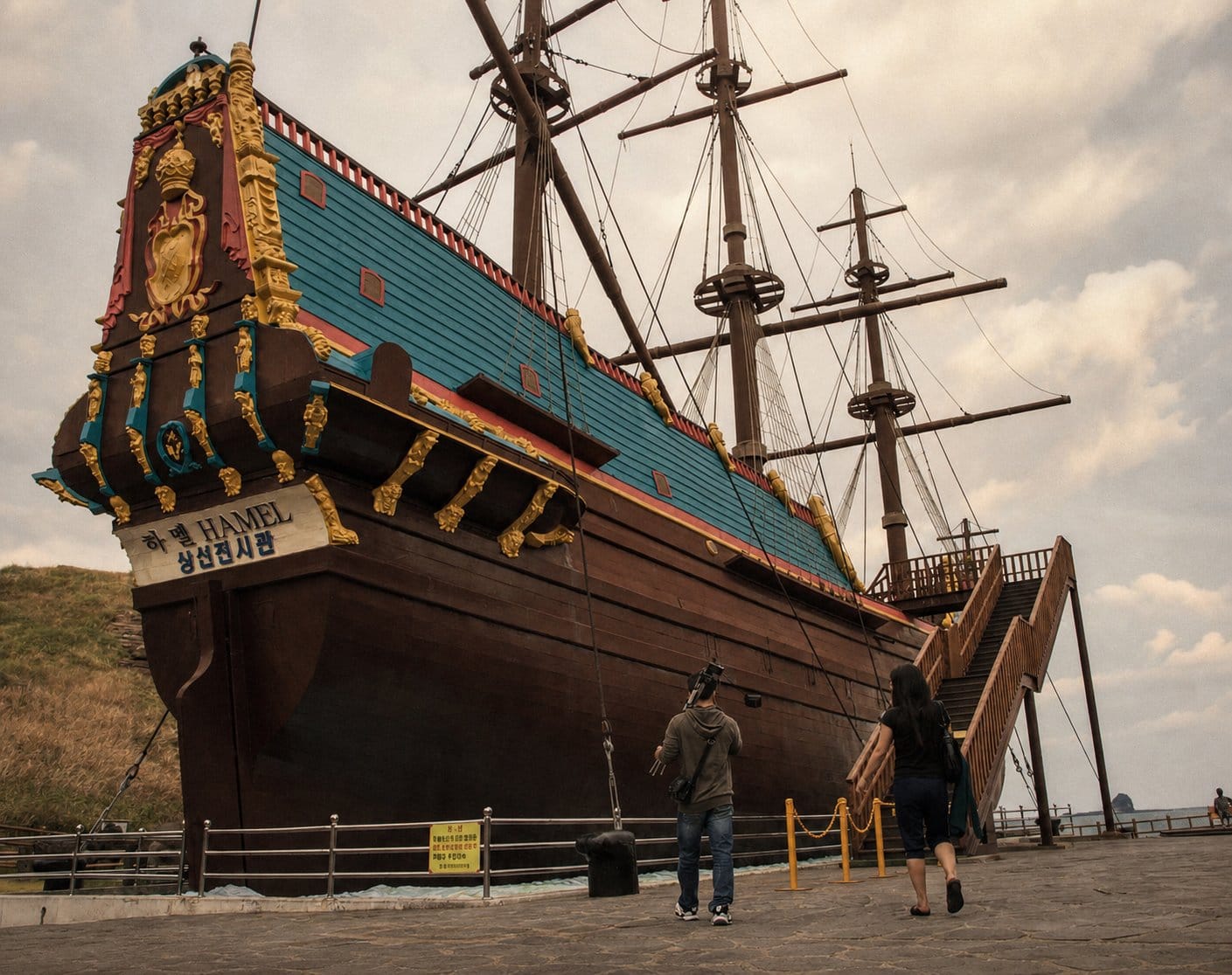
Hendrik Hamel (1630–1692) was a Dutch VOC bookkeeper whose 1668 published journal became the founding document of European knowledge about Joseon Korea — and the primary vehicle through which "Quelpart" entered permanent European cartographic use . In June 1653, Hamel departed the VOC's Asian headquarters at Batavia (modern Jakarta) aboard the yacht De Sperwer (The Sparrowhawk), bound for the trading post at Dejima in Nagasaki, Japan. The voyage went catastrophically off-course when a severe typhoon struck in August 1653, driving the ship onto the rocky southern coast of Quelpart. Of the 64 crew aboard De Sperwer, only 36 survived the wreck .
The survivors were immediately taken into custody by Korean authorities. Korea under the Joseon dynasty maintained one of the most rigorous isolationist policies in the world: the kingdom had no formal diplomatic relations with Western powers and prohibited foreigners from leaving once they had entered its territory. In May 1654, after approximately nine months on Quelpart, Hamel and the surviving crew were transported to the Korean mainland and formally presented to King Hyojong in the capital Hanyang (present-day Seoul) . They were subsequently assigned to a military unit, relocated multiple times across the peninsula, and saw their numbers diminish further through illness and hardship over the following decade.
Hamel spent thirteen years in Joseon Korea before successfully escaping in September 1666 with seven surviving crewmates, reaching the Dutch trading post at Dejima after a dangerous sea crossing . Back in the Netherlands, he compiled his observations into a journal published in 1668 under the title Journael van de Ongeluckige Voyage van't Jacht de Sperwer (Journal of the Unfortunate Voyage of the Yacht De Sperwer). A companion section, Beschrijvinge van het Koninkrijk Coeree (Description of the Kingdom of Korea), provided the most detailed European account of Korean geography, society, governance, and customs yet published.
"The description which follows of the Kingdom of Korea is not without value, since this is a country of which our world as yet has no knowledge, or very little." — Hendrik Hamel, Journael van de Ongeluckige Voyage van't Jacht de Sperwer, 1668, as cited by the Korean Mission to the Netherlands
The journal's publication had an immediate and lasting impact on European cartography. Prior to 1668, European maps of the Korean region were sparse and frequently inaccurate, drawing on fragmentary Portuguese portolans or secondhand Chinese and Japanese sources. Hamel's account provided latitude observations, coastal profiles, place names, and an extended firsthand narrative of Quelpart itself — all of which cartographers incorporated into the next generation of East Asian maps. The name "Quelpart" or "Quelpaert," tied to a precise location with described physical characteristics, became the standard European designation from that point forward. Dutch, French, and British maps from the late 17th century onward all reflected Hamel's account.
The legacy of Hamel's shipwreck is formally commemorated on Jeju today. The Hamel Shipwreck Memorial in Seogwipo marks the approximate location where De Sperwer went aground and remains one of the most tangible connections between 17th-century VOC maritime history and Jeju's contemporary identity. The Dutch-Korean cultural link established through Hamel's involuntary thirteen-year residency is recognized as a strand of both nations' shared heritage .
📍 View Hamel Memorial on Google Maps
Quelpart on European Cartography: A Name History Timeline
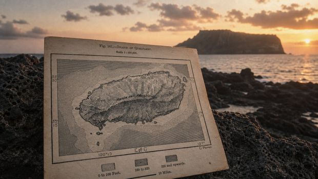
Hamel's 1668 journal gave European cartographers their first systematic, firsthand geographic description of Quelpart Island and the surrounding Korean coastline, anchoring the name across Dutch, French, and British maps for over two centuries . Before Hamel, the island appeared only sporadically and imprecisely on European charts — often labeled with a Portuguese-era designation or omitted entirely. After 1668, it became a named, precisely positioned island on virtually every major European map of East Asia, the cartographic footprint of a single published eyewitness account.
The name's spelling varied by national cartographic tradition. Dutch maps consistently used "Quelpaert" or "Quelpart." French cartographers, adapting the name to French phonetics, produced variants including "Quelpaërt" and, in some 18th-century transcriptions, the more explicitly phonetic rendering "Tchel-pa-to" — reflecting French attempts to approximate the Korean sound more closely. British Admiralty charts, drawing heavily on Dutch and French surveys, standardized on "Quelpart" as their preferred form throughout the 18th and 19th centuries. All these variant spellings appear in European cartographic archives and function as essential search terms for researchers working with pre-20th-century East Asian map collections.
| Period | Name on Maps | Dominant Cartographic Tradition | Key Event / Source |
|---|---|---|---|
| Pre-1600 | Absent or "Ilha de Ladrones" | Portuguese portolans | Early Portuguese East Asian coastal charts |
| 1648–1667 | Quelpaert (sparse) | Dutch VOC internal records | First attested VOC documentary use of the name |
| 1668–1700 | Quelpart / Quelpaert | Dutch; early French | Hamel's journal published 1668; name enters mainstream European cartography |
| 18th century | Quelpart / Quelpaërt / Tchel-pa-to | French, British, Dutch | Post-Hamel cartographic standardization across Western nations |
| 19th century | Quelpart / Quelpaert | British Admiralty; European atlases | British naval hydrography consolidates the spelling |
| Early 20th c. | Quelpart / Cheju | Western colonial maps; Japanese surveys | Japanese annexation 1910; McCune-Reischauer romanization introduces "Cheju" |
| 2000–present | Jeju | South Korean official romanization; all international maps | Revised Romanization of Korean adopted 2000 |
The 1914 publication "Forty Days in Quelpart Island" by naturalist Malcolm P. Anderson in San Francisco's Overland Monthly illustrates how long the European name persisted in Western popular and scientific writing even into the 20th century. Anderson documented a wildlife expedition to the island, describing Hallasan's summit view of over fifty cinder cones and collecting mammal specimens. Among his findings was a previously undescribed weasel he named Lutreola quelpartis in honor of the island . That zoological designation survives in formal biological taxonomy — making "Quelpart" the only European name for Jeju to have achieved permanent standing in Latin scientific nomenclature, still in use by zoologists over a century after the European name itself fell out of general use.
Historical Quelpart maps have become collector items in European cartographic markets. The name functions as a key search term in Korean diaspora history, Dutch colonial history, and East Asian cartography scholarship. The Jeju Guru archive maintains one of the more accessible English-language online collections of Quelpart-related historical texts for those beginning research in this area.
Jeju's Indigenous Names: From Tamna to Modern Jeju
Long before European sailors gave the island any name, Jeju was known as Tamna (탐라) — an independent maritime polity and one of the oldest recorded political entities on the Korean peninsula . Also rendered as Tammora in some historical records, the Kingdom of Tamna maintained its own royal lineage, a distinct language, and maritime trading relations with the Korean mainland, Japan, and China. Its foundation mythology centers on three demigods — Go, Yang, and Bu — said to have emerged from three holes in the slopes of Hallasan and become the progenitors of Jeju's original clans. These clans, according to Tamna tradition, later received wives who arrived by ship carrying seeds, animals, and agricultural tools — a founding story that encodes the island's character as both maritime and agrarian from its earliest recorded self-conception.
Tamna's political autonomy eroded gradually across the first millennium CE. In 662 CE, the kingdom became a protectorate of the Silla kingdom following diplomatic submission . By 938 CE it had come under Goryeo authority, though retaining some degree of local governance. The final loss of meaningful autonomy came in 1105 CE, when the Goryeo court formally renamed the island "Jeju" — a Sino-Korean compound meaning roughly "across the sea" or "province beyond the sea" — and fully incorporated it into the Goryeo administrative structure . This 1105 renaming is historically significant: it is the same "Jeju" that, after nine centuries and multiple romanization reforms, carries the island's official modern name.
The Mongol period (1271–1367) brought another substantial transformation. After the Mongols established the Yuan dynasty over Goryeo, they recognized Jeju's strategic value and converted the island into a major horse-breeding center to supply the Mongol Empire's cavalry across East Asia . Horses became central to the island's economy and material culture; Jeju horse breeds descended from Mongol stock are a recognized element of Jeju's historical heritage. The Mongol presence, lasting nearly a century, left lasting imprints on local vocabulary, place names, and agricultural practice — a stratum of cultural influence that predates European contact by several centuries.
Under the Joseon dynasty (1392–1897), Jeju served primarily as a destination for political exile — a role that paradoxically enriched the island's intellectual culture as scholars, officials, and artists brought mainland literary and artistic traditions with them. Japanese colonization beginning in 1910 introduced another wave of administrative restructuring. The most traumatic event in the island's modern history was the Jeju April 3rd Uprising (4·3 사건) of 1948–1949: a brutal suppression of a leftist guerrilla insurgency in which approximately 30,000 people — roughly one-tenth of the island's total population — were killed . The South Korean government's formal apology for state abuses connected to that event came decades later and remains a significant moment in modern Korean historical reckoning. In 2006, Jeju became South Korea's first and only special self-governing province — a status that reflects both its geographic separateness and a deliberate policy effort to restore something of the island's historic distinctiveness within the South Korean state.
Jeju's Volcanic Landscape and UNESCO Heritage Status
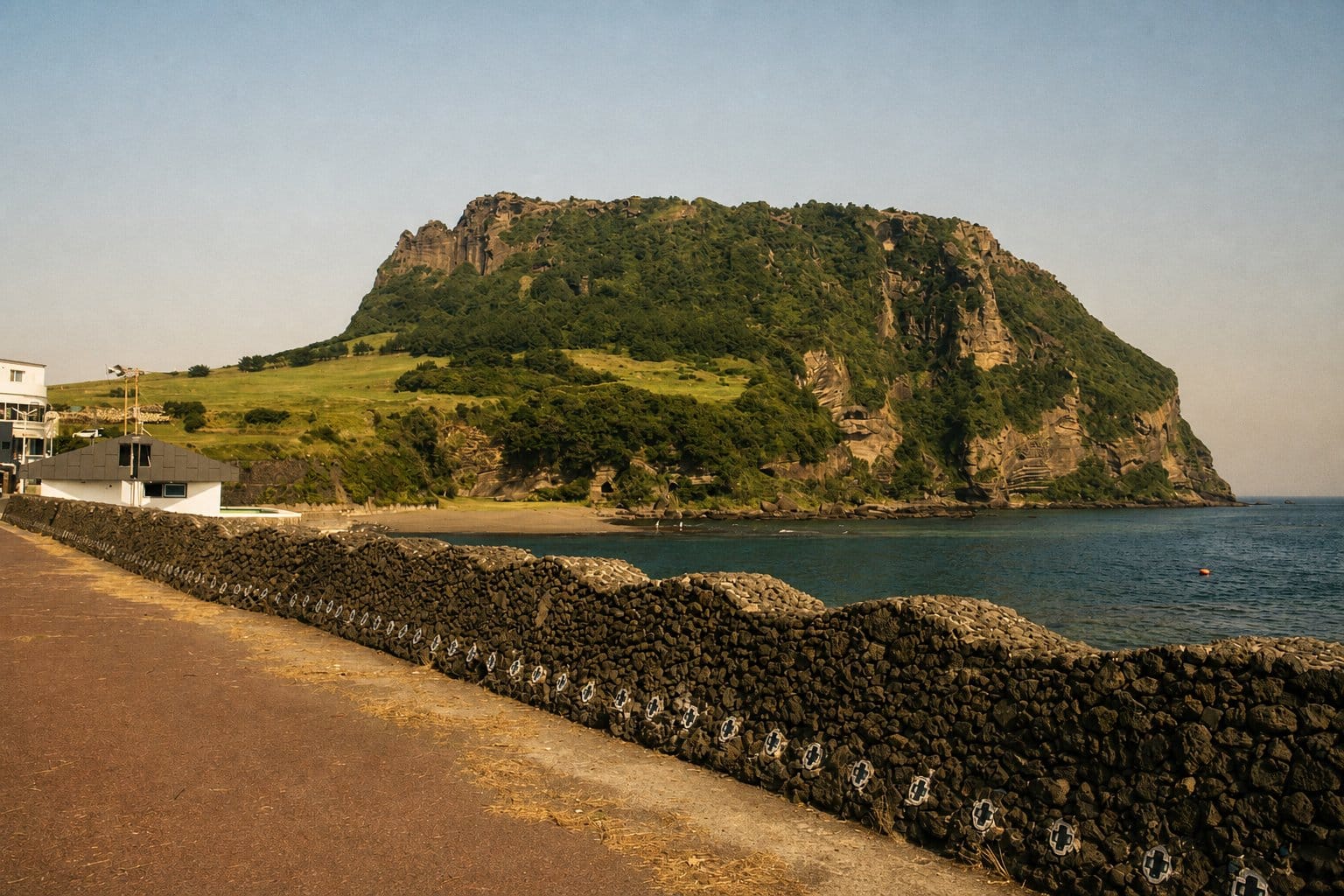
Jeju Island is a volcanic shield island formed by submarine eruptions approximately 2 million years ago , with the most recent volcanic activity dating to approximately 8,000 BCE. At the island's center stands Hallasan (한라산), an extinct shield volcano rising 1,950 meters above sea level — South Korea's highest peak — topped by a crater lake called Baengnokdam . Surrounding Hallasan are approximately 360 smaller parasitic volcanic cones called oreum, which dot the island's landscape in nearly every direction. These geological features were already visible to European sailors approaching from the south — the volcanic silhouette made Jeju unmistakable and distinctive at sea, distinguishing it from any other coastline on the Korea-Japan trade corridor and giving it lasting value as a navigational reference point long before it had a fixed European name.
📍 View Hallasan on Google Maps
"From the top of [Hallasan], I could count more than fifty cinder cones spreading away in every direction — a landscape unlike anything on the Korean mainland." — Malcolm P. Anderson, naturalist, "Forty Days in Quelpart Island", Overland Monthly, January 1914
The Manjanggul Lava Tube, with individual passages reaching up to 30 meters in height and a total documented length of approximately 13.4 km, is among the world's longest lava tube systems and one of Jeju's most significant geological features . The Jusangjeolli basalt column formations along the southern coast — geometric hexagonal columns formed as lava cooled rapidly against seawater — are another direct product of the island's volcanic genesis and now function as one of its most photographed coastal landmarks.
📍 View Manjanggul Lava Tube on Google Maps
In 2007, "Jeju Volcanic Island and Lava Tubes" was inscribed as a UNESCO World Heritage Site , with the designation covering the Geomunoreum lava tube system (including Manjanggul), Seongsan Ilchulbong tuff cone, and Hallasan Natural Reserve — three distinct geological expressions of the island's volcanic origin. Jeju additionally holds UNESCO designations as a World Geopark and a Biosphere Reserve, placing it in rare international company: fewer than a handful of sites worldwide simultaneously hold all three major UNESCO environmental classifications .
📍 View Seongsan Ilchulbong on Google Maps
For anyone approaching Jeju with the European naming history in mind, the geological landscape provides a visceral connection to the island's cartographic past. The same volcanic profile that VOC navigators used as a sea-chart landmark for three centuries is unchanged from the "Quelpart" that appeared on 17th-century Dutch charts — a permanent geological fact underlying a layered history of imposed and reclaimed names.
Frequently Asked Questions
Why was Jeju Island called Quelpart by Europeans?
European sailors and cartographers used "Quelpart" (also spelled Quelpaert or Quelpaërt) as the standard name for Jeju Island from at least 1648. Two main theories explain the origin: the first links the name to a Dutch VOC vessel called the Quelpaert that sighted the island while sailing from Taiwan to Japan; the second proposes that the name is a phonetic corruption of the Korean gyul-bat (귤밭), meaning "citrus grove" or "orange field," which early sailors misheard when asking local Koreans what the island's distinctive coastal groves were called. The two theories may be complementary — the ship may itself have been named after an earlier phonetic approximation of the Korean term. Dutch mariner Hendrik Hamel's 1668 journal — the first detailed Western account of Korea — fixed "Quelpart" on European maps for more than two centuries, where it persisted until South Korea's Revised Romanization reform in 2000 standardized the modern spelling "Jeju."
Who was Hendrik Hamel and what is his connection to Jeju?
Hendrik Hamel (1630–1692) was a Dutch VOC bookkeeper who became the most significant early Western writer on Korea entirely by accident. In June 1653, he departed Batavia aboard the VOC yacht De Sperwer, bound for Japan. A typhoon struck in August 1653 and wrecked the ship off Quelpart's southern coast; only 36 of 64 crew survived. Korean authorities captured the survivors, who were held in Joseon Korea for 13 years under the kingdom's strict isolationist policy. Hamel escaped to the Dutch trading post at Dejima, Japan, in 1666, returned to the Netherlands, and in 1668 published his account of the voyage and captivity — the first detailed eyewitness Western record of Joseon-era Korea. The journal's geographic descriptions of Quelpart and the Korean mainland cemented "Quelpart" as the standard European name for the island across Dutch, French, and British cartography for the following two centuries.
What did the Portuguese call Jeju Island before 'Quelpart'?
Portuguese navigators labeled Jeju Island "Ilha de Ladrones" (Island of Thieves) during the 16th century, following a common Portuguese cartographic convention of naming islands after first-encounter experiences with local inhabitants. The label carried no information about the island's indigenous identity or political status under Joseon Korea — it was a maritime hazard notation, not a formal geographic designation. As the Dutch VOC displaced Portuguese traders across East Asian sea routes during the early 17th century, Dutch cartographic terminology — including the name "Quelpaert" or "Quelpart" — replaced Portuguese designations on maps of the region. The Dutch name was attested in records by 1648 and became the dominant European convention after Hamel's 1668 journal disseminated it broadly across the Western cartographic community.
When did the spelling change from 'Cheju' to 'Jeju'?
The spelling shift from "Cheju" to "Jeju" occurred in 2000, when South Korea officially adopted the Revised Romanization of Korean system and standardized the romanization of the island's name as "Jeju." The earlier spelling "Cheju" had been used in Western and colonial-era texts throughout the early-to-mid 20th century, reflecting the McCune-Reischauer romanization system that preceded the 2000 reform. Before either modern romanization, European maps used "Quelpart" or "Quelpaert" for most of the 17th, 18th, and 19th centuries. Researchers searching historical archives should therefore know all three major name conventions: Quelpart (pre-20th century), Cheju (early-to-mid 20th century), and Jeju (2000 to present) — each corresponding to a distinct era in how the outside world documented this island.
What was Jeju's original name before it was called Jeju?
Jeju's original name was Tamna (탐라), also spelled Tammora — the name of an independent maritime kingdom that occupied the island from antiquity and is one of Korea's oldest recorded polities. Tamna maintained its own royal lineage, a distinct language, and trading relations with neighboring peoples on the Korean peninsula, in Japan, and along the Chinese coast. The kingdom became a Silla protectorate in 662 CE, came under Goryeo authority in 938 CE, and was formally renamed "Jeju" — a Sino-Korean term meaning roughly "across the sea" or "province beyond the sea" — in 1105 CE under Goryeo rule. With that renaming, the island lost its remaining formal autonomy. The name "Tamna" survives in Jeju historical scholarship, cultural references, and the island's foundation mythology, but it has not functioned as the island's official administrative designation for over nine centuries.
From Quelpart to Jeju: What the Name Shift Tells Us
The history of the name "Quelpart" is, at its core, a history of who held knowledge-production authority over a corner of the world at a given moment. Portuguese sailors named the island after their own encounter with it; Dutch traders named it after a ship, a citrus grove, or both; Hamel's enforced thirteen-year residence turned a navigational notation into a detailed geographic description that shaped European understanding for two centuries; and French, British, and German cartographers perpetuated a Dutch-origin name long after Dutch maritime dominance had itself waned. The island's indigenous names — Tamna, and then Jeju — were present throughout all of this but invisible to the European record until Korea opened its borders and Western scholarship began engaging seriously with Korean-language historical sources.
The 2000 adoption of "Jeju" as the internationally recognized spelling was not merely a bureaucratic romanization decision. It was South Korea asserting the right to name its own territory on its own linguistic terms — the final step in a centuries-long process by which an island that European sailors called Quelpart became, once again, Jeju on every authoritative map in the world. For historians and archivists, the name "Quelpart" remains essential: it unlocks a vast body of 17th- through 19th-century European sources — expedition reports, natural history publications, ship logs, and admiralty charts — that are effectively invisible if you search only under "Jeju" or even "Cheju."
Practical research guidance: when searching European archives or historical databases for material on Jeju Island, use "Quelpart" or "Quelpaert" for any source before approximately 1900, "Cheju" for sources from 1900 to 2000, and "Jeju" for sources from 2000 onward. The three-name sequence is not a complication — it is the periodization index for three distinct eras of how the outside world documented and named this island. Knowing all three is the single most practical tool for navigating Jeju's pre-modern Western historical record.
Last updated: 2026-05-29. This article was researched and written based on sources current as of May 2026, including Wikipedia: Jeju Island, Encyclopædia Britannica, the New World Encyclopedia, the Atlas of Mutual Heritage, and the Korean Mission to the Netherlands historical records portal.


